Home »
Our projects and experience
Partners and clients of the team were among all: University of Warsaw, Jagiellonian University, Marcin Szender MSP (now MSP Inntech Sp. z o.o.), Infomatico Tomasz Kozłowski, Międzychód Forest Inspectorate, Astri Polska and IMGW-PIB.
Experts from UAV GeoLab take part in archaeological research conducted by the Jagiellonian University and University of Warsaw as well as by foreign entities, documenting cultural heritage with photogrammetric methods. In cooperation with commercial partners, they also carry out industrial research and development works as part of ongoing projects.
Ongoing projects:
SYMBIoNT - Support for Construction Sites with UAV Platforms and Artificial Intelligence
Conducted with Skysnap sp z o.o. company
Project duration: 2025-2026
The SYMBIoNT project focuses on research into a solution aimed at creating synergy between current construction management and monitoring processes and modern measurement techniques, including artificial intelligence. The main goal is to optimize the process of monitoring the migration of key construction materials on a linear investment—from the moment they enter the construction site until the completion of the structure.
Finished projects:
Inventory of the technical condition of the cubature real rstate based on the use of UAV and AI
Conducted with Skysnap sp z o.o. company
Project duration: 2022-2023
Improving methods of acquisition and processing of remote sensing data from unmanned aerial vehicles
Conducted with Dragonfly Vision company
Project duration: 2021-2023
R&D works in inventory and modelling of key technical and transport infrastructure objects in BIM technology using AI tools in the process of drone data processing
Conducted with Skysnap sp z o.o. company
Project duration: 2021-2023
Synergy and application of voluminous datasets obtained with integrated mobile mapping platform equipped with LIDAR and GPR
Conducted with the Faculty of Civil Engineering Warsaw University of Technology
Project duration: 2021-2022
MA-P Maloutena and Agora in the layout of Paphos: modelling the cityscape of the Hellenistic and Roman Capital of Cyprus
Conducted with Jagiellonian University and Polish Centre of Mediterranean Archaeology University of Warsaw
Project duration: 2020-2025

Advanced technologies in the prevention of flood hazard – SAFEDAM
Conducted with Astri Polska, IMGW-PIB, MSP Marcin Szender and CS PSP in Częstochowa
Project duration: 2016-2020
The aim of the project was to develop a system for levee monitoring with the use of a non-invasive, unmanned aerial platform, scanning from a low flight level using aerial and satellite imagery. The system uses multi-source photogrammetric data: satellite (optical and radar), aerial (archival LiDAR data and orthophotos) and UAV.
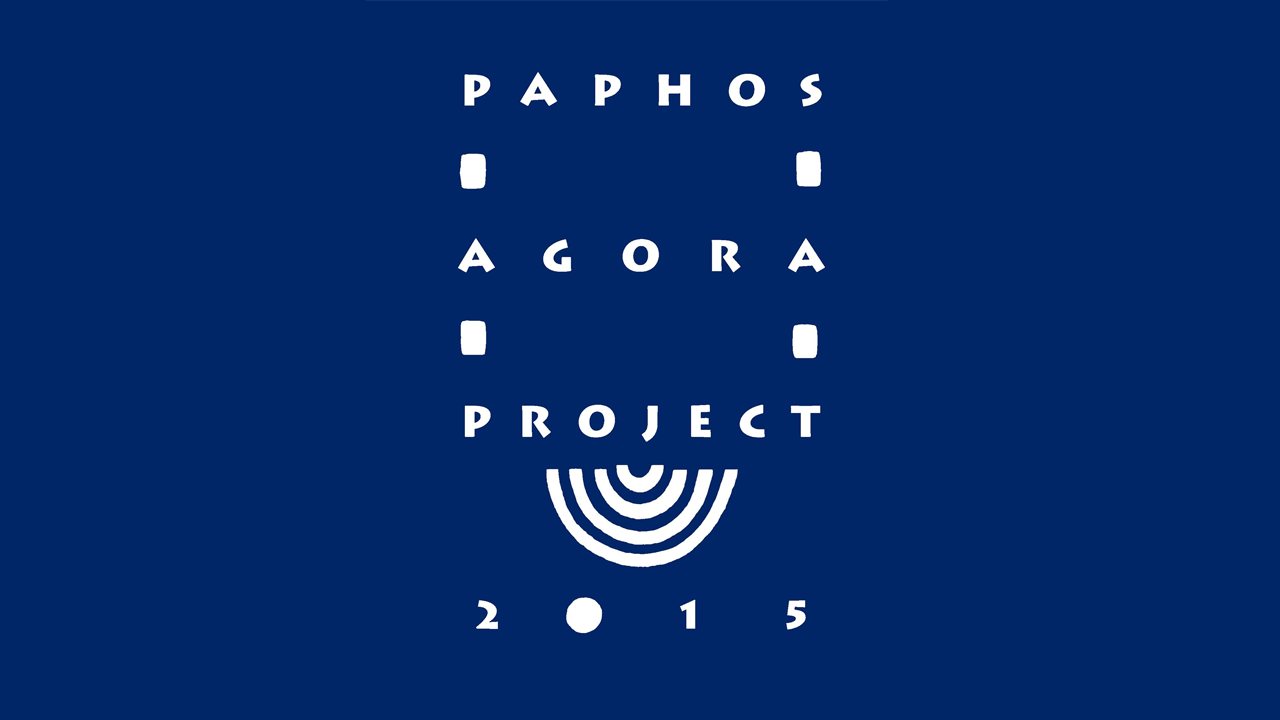
Paphos - Agora and the infrastructure and economic activity of the capital of Hellenistic and Roman Cyprus based on interdisciplinary research
Conducted with Jagiellonian University
Project duration: 2016-2020
The aim of the project was to study the Agora of the ancient city of Nea Paphos (Cyprus) and its relationship with the city's economic infrastructure. The project used non-invasive methods including satellite imagery, archival aerial photography and drone imagery for research and archaeological excavation documentation.
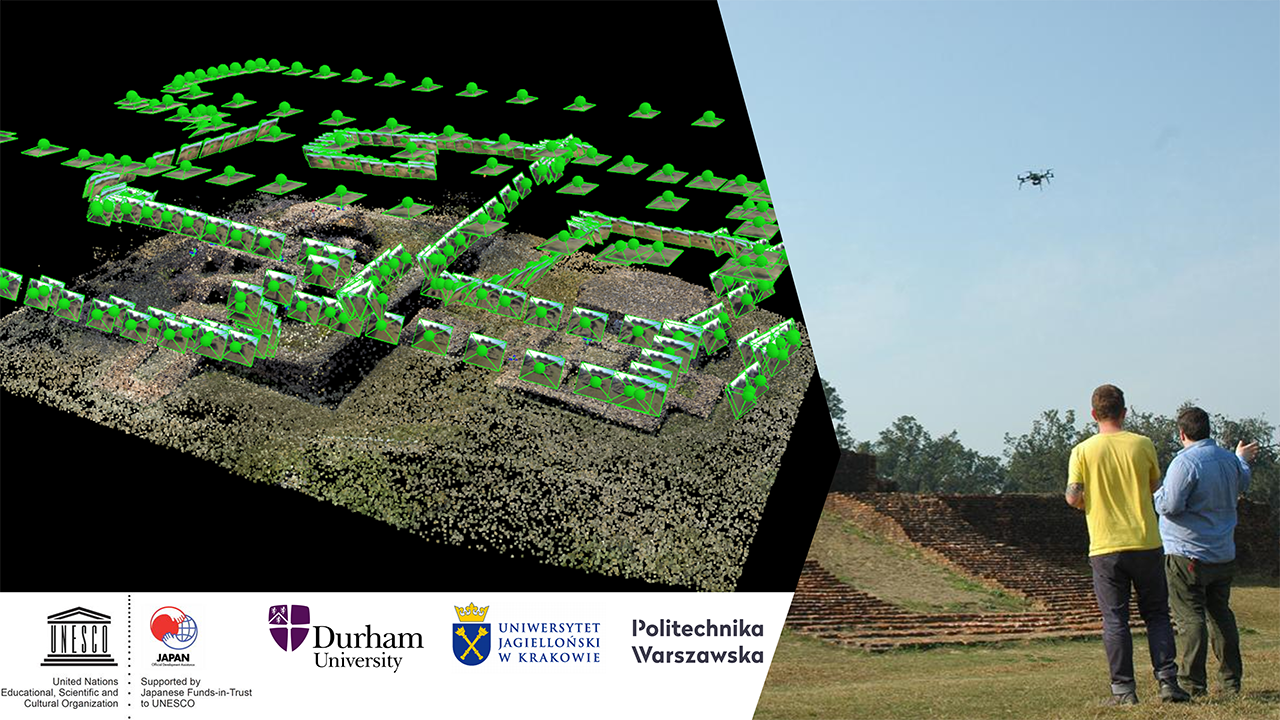
Strengthening the Conservation and Management of Lumbini, the Birthplace of Lord Buddha, the World Heritage Property (Phase II)
Conducted with Durham University, UNESCO/Japanese Funds-in-Trust Project for the Preservation of World Heritage
Project duration: 2015
The aim of the project was to increase knowledge of ancient Tilaurakot and Lumbini in Nepal, where the Buddha was born, and to carry out conservation and heritage management work in and around Tilaurakot. As part of the project, photogrammetric products (DTMs, Ortho, 3D models) from UAV imagery for three archaeological sites in the vicinity of Tilaurakot were produced for Durham University in collaboration with archaeologists from the Jagiellonian University.
Implementations and methodologies:
• Implementation of an IT system within the SAFEDAM project – the system is used to manage information on the risk of levee failure and to manage rescue operations during floods. Implementation carried out for the Public Treasury represented by the Commander of the National Fire Service in a consortium with Astri Polska, IMGW-PIB, MSP Marcin Szender and CS PSP in Częstochowa, financed by NCRD.
• Implementation of one of the first UAV measurement systems in Europe integrating ultralight laser scanner and RGB optical camera, mounted on a multi-rotor UAV (implemented with Marcin Szender MSP, now MSP InnTech sp. z o.o.)
• Developing a new service and methodology for carrying out measurements in support of road accidents documentation by means of photogrammetric accident inventory using unmanned aerial vehicles (implemented for Infomatico Tomasz Kozlowski, RPO WM)
• Expert opinion on the validation of orthophotomaps developed with the use of Trimble UX5 photogrammetric system at 100m, 200m and 300m above ground level for The Agency for Restructuring and Modernisation of Agriculture (ARMA)
• Quality control and expert support for the project entitled Assessment of the status of selected elements of the Biebrza National Park natural environment using remote sensing methods (Operational Programme Infrastructure and Environment, Biebrza National Park)
• Delivery of unmanned measurement system – laser scanner and camera, implementation with Marcin Szender MSP (now MSP InnTech sp. z o.o) and IMGW-PIB.
