Home »
Hardware& Software
Unmanned vehicles and sensors
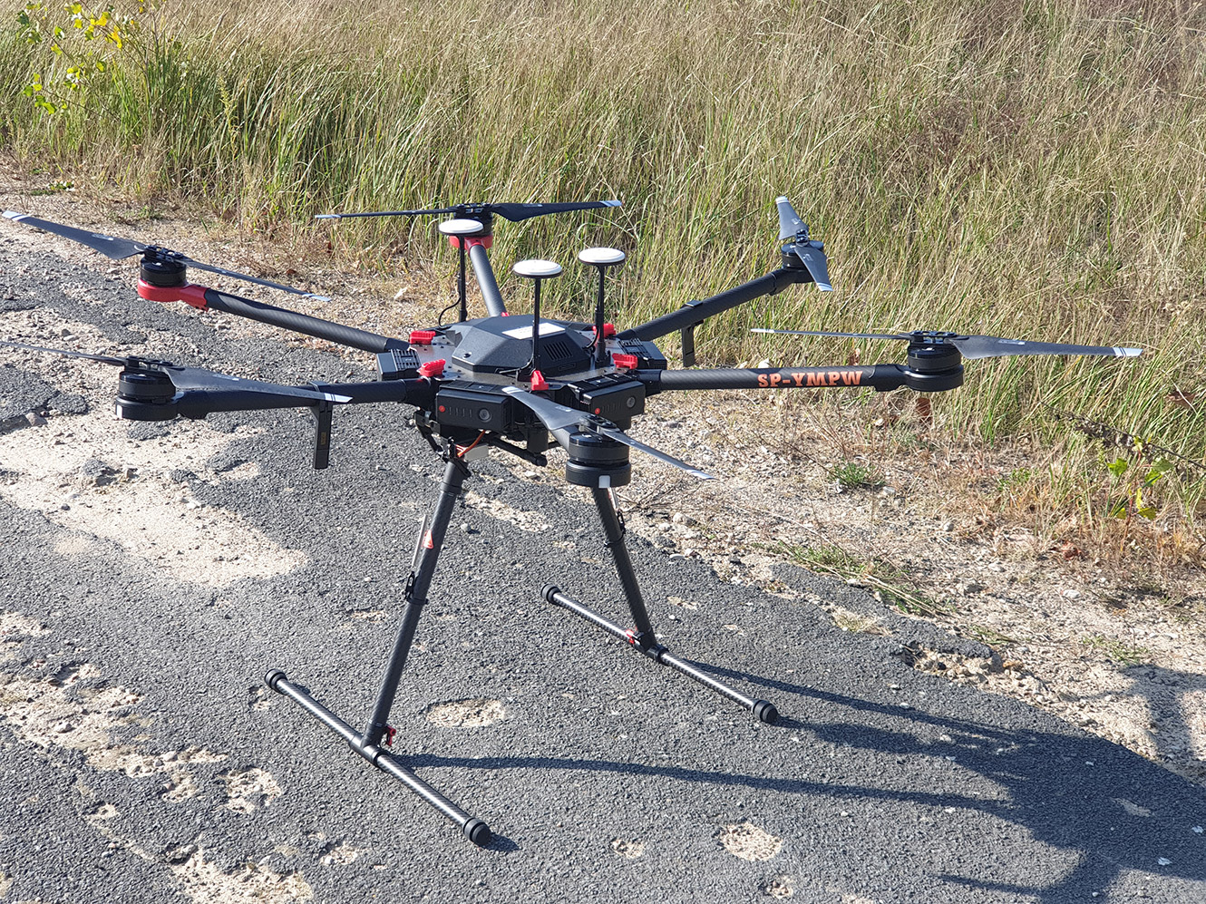
Matrice 600 (SP-YMPW) during preparation for the VLOS flight
Although performing UAV flights is not our primary research task, as a team we have several multi-rotor UAVs. We use DJI drones (Matrice 300 RTK, Matrice 600 Pro, Phantom 4 RTK) adapted and registered for Beyond Visual Line of Sight (BVLOS) missions. On a daily basis we perform photogrammetric missions with the following platforms:
• DJI Matrice 600 Professional (SP-YMPW),
• DJI Matrice 300 RTK,
• DJI Phantom 3 Professional (SP-YPPW),
• DJI Phantom 4 RTK,
• DJI Phantom 4 Pro V2.
We have top-of-the-line sensors:
• Riegl miniVUX-1 UAV lightweight laser scanner,
• DJI Zenmuse L1 laser scanner,
• Sony and Hasselblad RGB (+ IR) cameras,
• DJI Zenmuse P1 RGB camera,
• multispectral and thermal cameras,
• navigation reference sensors (Applanix APX-15).
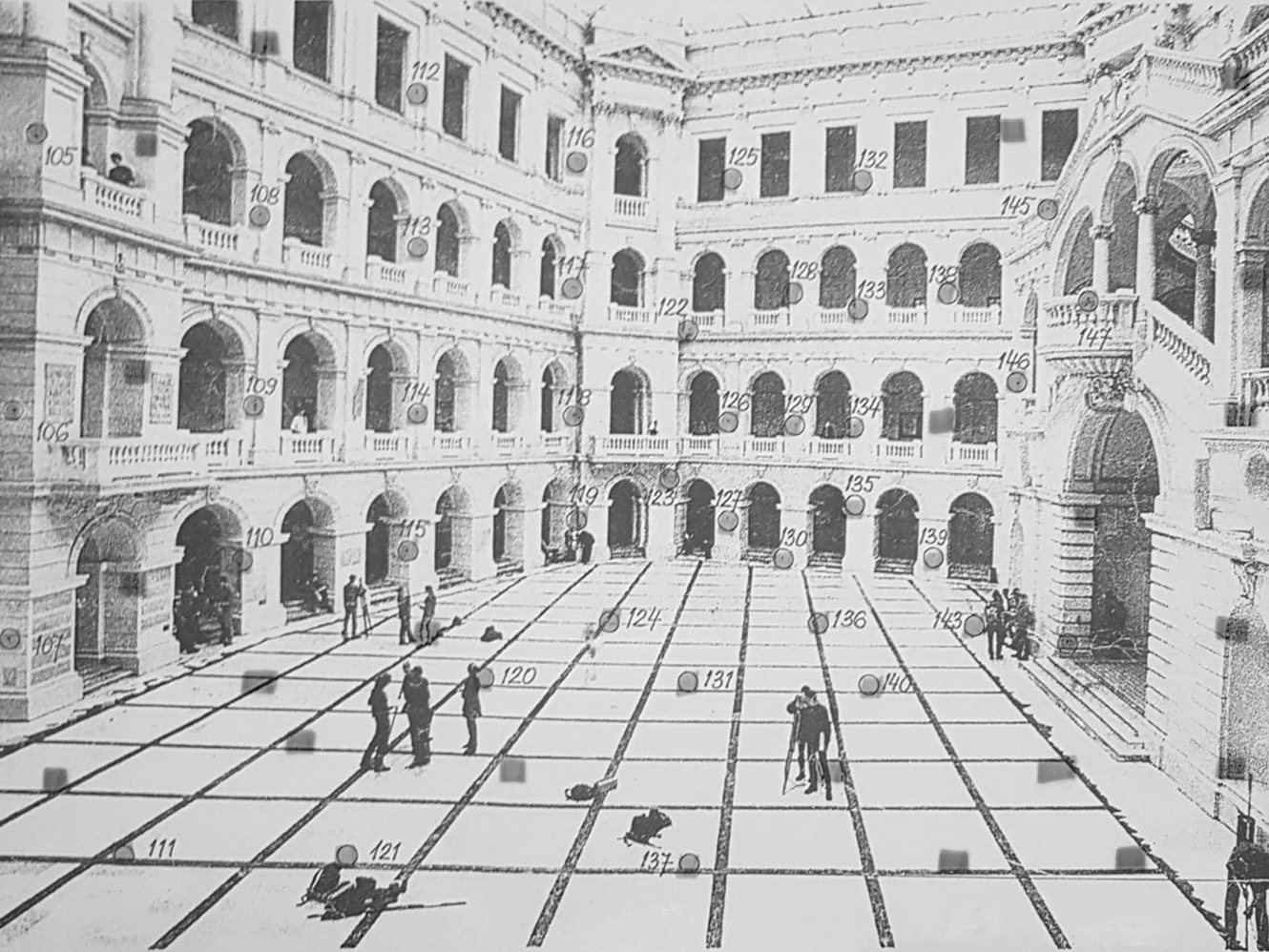
Przestrzenne pole testowe, do kalibrowania kamer w Dużej Auli Gmachu Głównego PW
Large Infrastructure
As a part of the Warsaw University of Technology we have been creating and developing unique research tools as well as we cooperate with other teams from WUT, which gives us access to unique infrastructure::
• Calibration Field located in the Main Hall in the Main Building of WUT,
• CENAGIS Research and Calculation Centre in Józefosław near Warsaw,
• Aviation Research Centre of the Warsaw University of Technology in Przasnysz.
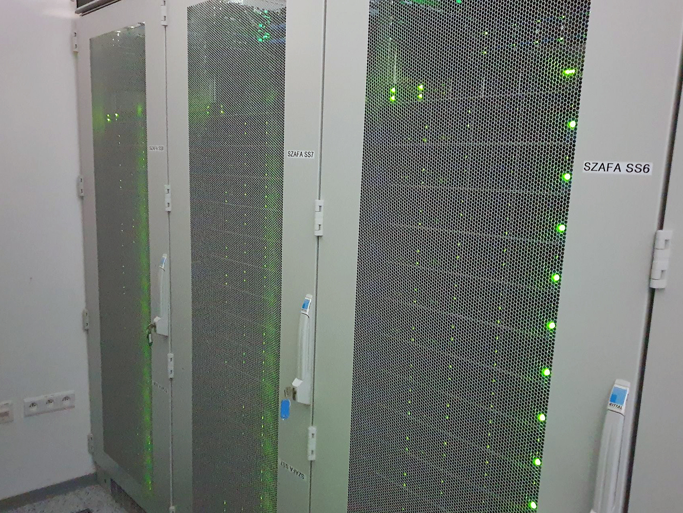
GPU servers, CENAGIS main computing power
Software
We have unique and wide, as for polish realities, access to the newest photogrammetric tools and programs - both research and commercial versions.
We have the following orientation and processing software:
• for low-altitude photogrammetry: Metashape Agisoft, Pix4Dmapper, Trimble Inpho-UASMaster, Bentley Context Capture, MicMac
• for airborne laser scanning data: Applanix POSPac, Terrasolid, RiProcess, DJI Terra.
We also have software for data processing and visualization in GIS and CAD environments (ArcGIS, Bentley Systems).