Home »
Our offer
Our activities are focused on four main fields:
Scientific Projects - Research & Development
We are open for R&D cooperation with companies and other scientific entities within scientific and implementation projects concerning UAVs. We are currently carrying out NCRD projects in the field of using UAV data and machine learning for natural environment and infrastructure inventory.
Więcej informacji na stronie Projekty.
Finished projects:
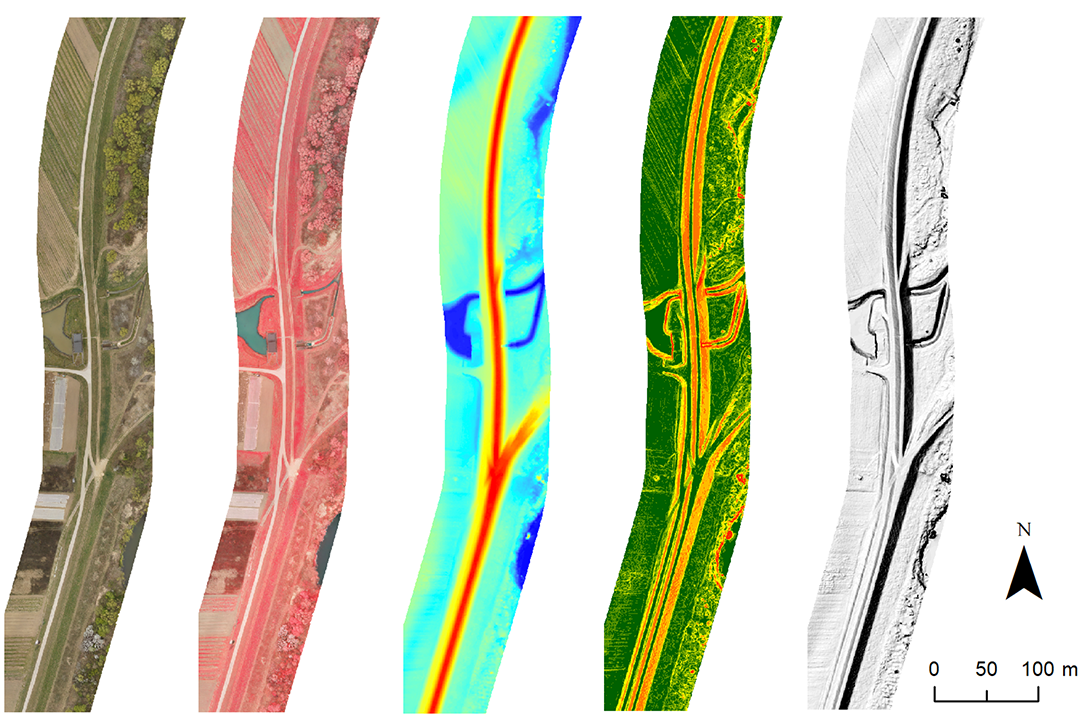
- • iplementation of the SAFEDAM system for monitoring the levee condition within the NCRD Defense project,
- • development of a service and methodology for photogrammetric documentation of accidents using UAVs,
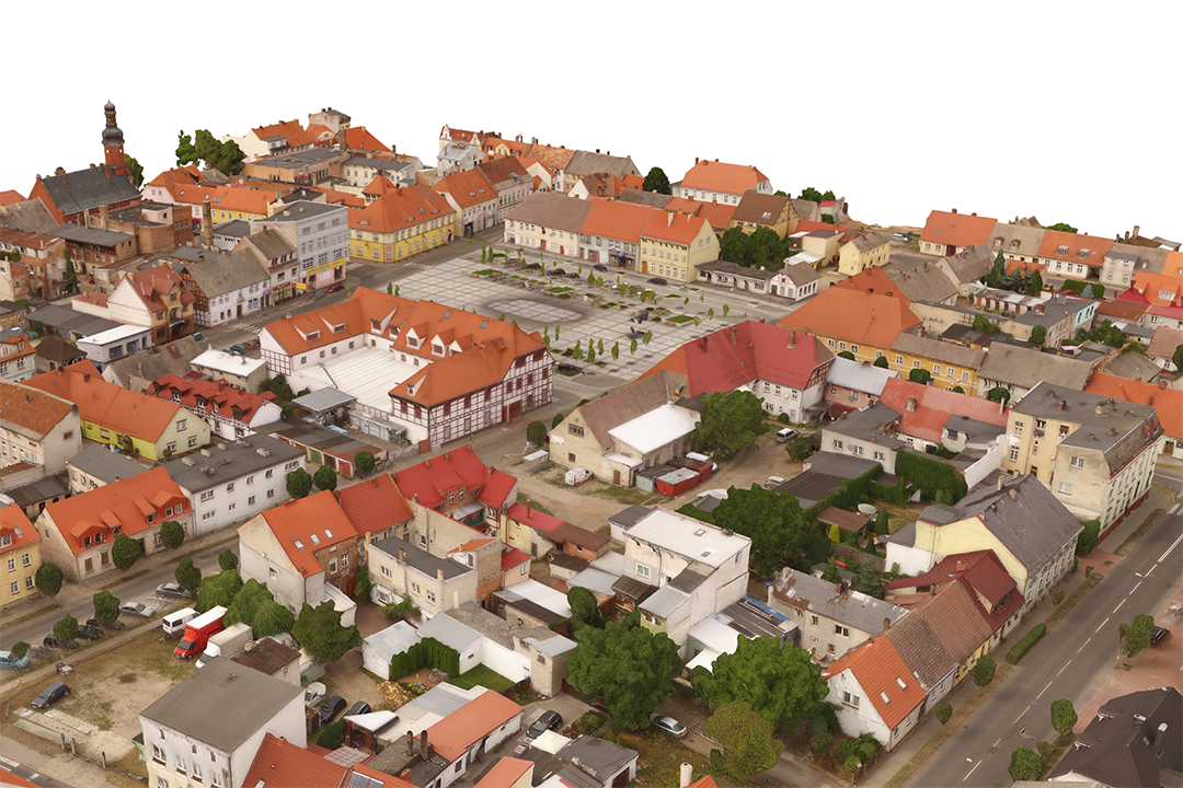
- • developing a methodology for acquiring 3D mesh models for small towns using oblique images from UAV.
Implementations, developed methodologies
We have experience with implementations and methodologies for government agencies and state or local government institutions.
Completed implementations:
- • implementation of one of the first UAV systems in Europe with an ultralight laser scanner,
- • validation of cameras and measurement systems for government agencies,
- • development of a methodology for obtaining 3D mesh models for small towns using oblique UAV images.
Trainings and workshops
We provide trainings and workshops on UAV data acquisition and processing.
Trainings examples:
- • trainings on software for UAV data processing,
- • workshops on comparison the capabilities of the most popular software,
- • problem-based workshops on radiometric correction of images from mulispectral UAV cameras and Trueorto generation.
Więcej informacji na stronie Szkolenia.
Expert services, consulting
We also offer expert services and support. For years we have been providing consulting services to various entities - local governments, national parks, etc. We assist in the implementation of projects, tenders and contracts.
We offer analyses and expert support in the field of:
- • validation of UAV sensors and products derived from them in terms of accuracy analysis as well as geometric and radiometric control,
- • UAV mission planning and UAV data ordering (in terms of orthophotomaps, elevation models and 3D city modelling, including descriptions for the tender procedures),
- • use of UAV data and remote sensing analyses (e.g. urban vegetation inventory and precision agriculture).
Implementation examples:
- • expert support while project realization (e.g. NFEP),
- • documentation of archaeological sites in Nepal for UNESCO/Japanese Funds-in-Trust Project for the Preservation of World Heritage.
We also perform camera calibrations and tests for photogrammetric applications. In 2022 we plan to open a new laboratory within CENAGIS.
